INDOOR MAPPING

Create Smarter  Experiences with Maps

Our indoor mapping platform, provides users with the tools to add intelligence to complex indoor spaces. With CXApp Mapping, users can create and bring indoor maps to apps, enabling multiple use cases using a single set of maps.

Map Your Offices

Copy of Solutions  By Role  IT Leaders

Transform Your Spaces with Indoor Mapping

Reduce Risk

Leverage a proven best-in-class indoor mapping solution and do it right the first time, across your buildings and facilities, worldwide.

Go to Market Faster

Quickly and easily deploy location-aware maps into apps on multiple platforms using our indoor mapping platform.

Support Multiple Use Cases

Extend indoor maps to address a variety of use cases using one centralized set of maps across your enterprise.

Indoor Mapping Website Page

What is Indoor Mapping?

Indoor mapping is the process of converting floorplans into digital, interactive representations of indoor spaces. In addition to serving as a wayfinding platform, indoor maps leverage business rules, localization and the IoT to enable users to visualize spatial data, creating real-time indoor location intelligence. With our indoor mapping platform, any system can be enhanced to display data in the context of an indoor map. 

Learn More About Indoor Mapping

How are Indoor Maps Created?

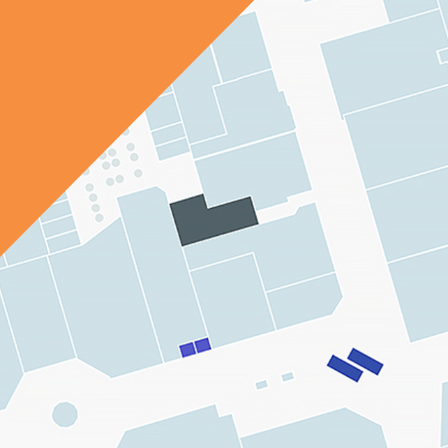
Our indoor mapping platform converts static maps (DWG, SVG, JPG, GeoJSON, PNG, PDF) into intelligent, multi-dimensional digital maps by overlaying multiple data layers to create scalable, location-aware applications. Indoor maps are integral to the creation of location-aware IoT-enabled smart buildings. These maps are then integrated with various platforms and data sets (your business data, third-party systems and data) via SDKs and APIs enabling a wide range of map-enabled use cases.

Quick Guide to Indoor Mapping for Enterprises

Updated (2)

Explore the Possibilities of Indoor Mapping

Discover how you can make your spaces smarter with map-enabled applications.

image-flash-2-7

Superior Maps

Our geospatially accurate vector-based maps are broken down into multiple layers and objects that can be associated with external data sources, and used to provide a high-fidelity and fluid user experience. 

money-shopping-bank-investing-and-banking-19

Turn-By-Turn Directions 

Improve the user navigation experience though on-screen turn-by-turn text directions with supporting visual landmarks. Built-in algorithms assist developers to calculate estimated travel times to destinations based on distance.

report

Map Profiles

Create customized experiences for different users by building permission-based profiles. Display or restrict access to different map views while managing a single map instance in the Content Management System.

interface-alert-alarm-bell-2-8

Map Updates

Edit maps on demand with our web-based Map Editor. This self-serve tool makes it easy for you to keep your maps up to date. 

resources-whitepaper

Map Styling

Quickly and easily customize the look and feel of your maps without having to write a line of code. Choose from a series of pre-styled templates or create your own. 

interface-edit-deploy-1-1

Localization

Cater to a global audience in their native language with local translations. Easily add and manage multiple languages using the Content Management System. 

operations

Data Management

Leverage the extensive Content Management System to create, manage and configure mapping data for multiple venues through a single system - in real-time. 

info-tech

Integrations

Our open architecture allows you to link and synchronize external systems and application data to maps using our RESTful APIs. 

interface-lighting-light-bulb-on-7

Code Samples

Save developers valuable time and get applications to market faster with an extensive library of sample code for web, iOS and Android platforms. 

Build and Manage Scalable, Location-Aware Apps 

We provide developers with tools to build map-enabled web and mobile (Android and iOS) applications. 

SDKs

Our SDKs abstract the data loading, initialization, rendering, module communication, and API interface with the application server allowing developers to focus on integration, styling and user experience. 

APIs 

Equipped with a library of secure REST APIs, our platform can easily be extended to link and synchronize external systems and data to your maps while having centralized management of all associated data. 

CMS

Our indoor mapping CMS is used to create, view, manage and edit maps and venue data across a global portfolio of buildings in real-time. 

Map Formats We Support

CXApp Mapping is a versatile and flexible indoor mapping platform that allows you to ingest and export maps in a variety of formats saving time and removing friction from the map import process.

Import

  • GeoJSON: Import GeoJSON compliant indoor maps into the CXApp Mapping platform 
  • PNG/JPG: Reduce the time it takes to get a project started by uploading your own map images for use in kiosks and digital signage 

Export

  • CAD: Extract maps, with all your saved changes reflected, in a CAD-friendly format (.DXF) 
  • GeoJSON: Share maps globally by exporting indoor maps and data to GeoJSON open standard format 
  • SVG/PDF/PNG: Quickly and easily generate full or partial snapshot images of your map and for promotional and marketing content 
  • IMDF: Easily export IMDF-configured venues as IMDF files 

Become a Pro with These Office Mapping Resources

{title=How Indoor Maps Facilitate Facilities Management, date=September 24, 2019, author=Alex Le, types={name=null}, tags=[Worktech, Facility Management], image=https://23501314.fs1.hubspotusercontent-na1.net/hubfs/23501314/Imported_Blog_Media/blog-image-facilities-hvac-Jul-10-2020-07-32-28-44-PM-2.jpg, snippet=Autumn is an exciting time in the world of property technology. In October, CoreNet Global's North American summit will bring together thousands of corporate real estate industry professionals. The aim of the summit is to connect and explore the ..., link=https://cxapp.com/blog/how-indoor-maps-facilitate-facilities-management, linkText=Read Post, newTab=false}
How Indoor Maps Facilitate Facilities Management
WorktechFacility Management How Indoor Maps Facilitate Facilities Management Autumn is an exciting time in the world of property technology. In October, CoreNet Global's North American summit will bring together thousands of corporate real estate industry professionals. The aim of the summit is to connect and explore the ...
{title=3 Key Benefits of Indoor Maps for Workplaces, date=January 27, 2021, author=Alex Le, types={name=null}, tags=[Worktech], image=https://23501314.fs1.hubspotusercontent-na1.net/hubfs/23501314/Wayfinding%20%281%29.png, snippet=Our dependence on maps has grown to the extent we cannot navigate without them. We've gone from paper maps to digitized maps on devices that depend on GPS. This is all great for the outside world, but what's taking place inside corporate buildings? ..., link=https://cxapp.com/blog/benefits-of-indoor-maps-for-workplaces, linkText=Read Post, newTab=false}
3 Key Benefits of Indoor Maps for Workplaces
Worktech 3 Key Benefits of Indoor Maps for Workplaces Our dependence on maps has grown to the extent we cannot navigate without them. We've gone from paper maps to digitized maps on devices that depend on GPS. This is all great for the outside world, but what's taking place inside corporate buildings? ...
{title=9 Ways Companies Are Using Wayfinding Software, date=March 12, 2023, author=Chris Wiegand, types={name=null}, tags=[Worktech], image=https://23501314.fs1.hubspotusercontent-na1.net/hubfs/23501314/9%20Ways%20Companies%20Are%20Using%20Wayfinding%20Software.png, snippet=Wayfinding technology has increasingly become an invaluable tool on corporate campuses around the world. In a workplace experience platform, wayfinding goes far beyond simple navigational cues showing users how to find their way from point A to ..., link=https://cxapp.com/blog/ways-companies-are-using-wayfinding-software, linkText=Read Post, newTab=false}
9 Ways Companies Are Using Wayfinding Software
Worktech 9 Ways Companies Are Using Wayfinding Software Wayfinding technology has increasingly become an invaluable tool on corporate campuses around the world. In a workplace experience platform, wayfinding goes far beyond simple navigational cues showing users how to find their way from point A to ...

Bring Locational Awareness to Your Facilities. Get Started Today.

  1. Request a Demo

    Let our workplace experts know that you’d like to explore how our indoor mapping works in real-time!

  2. Get In Touch

    Our workplace experts will personally reach out to you to gain a better understanding of the indoor mapping pain points you’d like to solve at your company.

  3. Guided Tour

    Explore every indoor mapping use case, feature and integration you’re curious about with your workplace advisor!

Schedule a Demo